| Daily Updates: May
2003 |
| S | M | T | W | T | F | S |
| |
|
|
|
1 |
2 |
3 |
| 4 |
5 |
6 |
7 |
8 |
9 |
10 |
| 11 |
12 |
13 |
14 |
15 |
16 |
17 |
| 18 |
19 |
20 |
21 |
22 |
23 |
24 |
| 25 |
26 |
27 |
28 |
29 |
30 |
31 |
| Daily Updates: June
2003 |
| S |
M |
T |
W |
T |
F |
S |
| 1 |
2 |
3 |
4 |
5 |
6 |
7 |
| 8 |
9 |
10 |
11 |
12 |
13 |
14 |
| 15 |
16 |
17 |
18 |
19 |
20 |
21 |
| 22 |
23 |
24 |
25 |
26 |
27 |
28 |
| 29 |
30 |
|
|
|
|
|

TODAY'S WEATHER
Cloudy, Light Rain
73°F (22.8°C)
Latitude: 38° 13'N
Longitude: 60° 36'W
Wind Direction: SSW
Wind Speed: 21 Knots
Sea State: 3
Sea Temperature: 70°F (21.1°C)
Swell(s) Height: 8 Foot
Barometric Pressure: 1013.0 MB
Visibility: 0.25 Nautical Miles

BREAKFAST
Scrambled eggs
Cheese/pepper omelets
French toast
Tater tots
Homemade streusel coffee cake
Sausage links
Oatmeal
Breakfast-on-the-run sandwich
LUNCH
Ida's minestrone
Hot ham and cheese sandwich
New Zealand green mussels gratins
Vegetable rice
French Fries
Succotash
Tapioca pudding and topping
DINNER
Grilled lamb chops
Halibut fillet with hotel butter
Basmati rice
Couscous with pesto
Zucchini ratatouille
Mixed vegetables
Wheat rolls
Berry butter crisp
Mowing the lawn
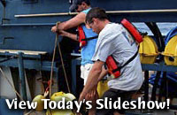
May 28, 2003
By Joe Appel
By this morning, RV Atlantis had arrived
at its first main target: Manning seamount.
This marked a turning point, literally, as the ship no longer was sailing straight
for a destination, but instead began to pace back and forth over the undersea
mountain. While making these multiple passes, known as mowing the lawn, SeaBeam
sonar was zipping back and forth between the ship bottom and the sea floor.
That sonar gave us data that provided much
more accurate maps of the mountain than satellite photos can.
This work is crucial for the upcoming Alvin dives. Manning
Seamount alone covers an area of between 800 and 900 square nautical
miles, so sending Alvin down without a good idea of the shape
of the mountain and likely areas for corals would be a huge waste
of time and energy. And Alvin is set for its first dive of the
cruise at 7:30 tomorrow morning.
Scientists Laura Robinson and Alex Gagnon were in charge of devising the ideal
path for RV Atlantis to take in order to provide more accurate maps of
the region. They had many parameters to consider, including the speed of the
ship, the amount of time available, the area to be covered, and the fact that
at different depths the region that the boat’s sonar soundings can cover
is different.
We wanted to look at the whole of the Manning Seamount but we are limited by
the time we have and by the width of the line surveyed by the SeaBeam.
As the ship crew prepares for our first Alvin dive tomorrow, there’s
no doubt that plenty more undersea surprises await.
Here’s the problem, in their words:
| Mathematical
Problem |
We
have given you a map with a box of the area we wanted to
map. Can you work out how long it takes to map the whole
area? You may solve the problem either graphically or mathematically.
Information necessary to solve the question:
Ship speed = 11 knots (11 nautical miles per hour)
Area to cover = 1260 square nautical miles
The sides of the box in the map are 28 nautical miles by 45 nautical miles. You
can use these as a scale.
We collect 2 nautical miles of mapping data on either side of the
ship’s
path as we sail by. So, your lines cannot be more than 4 nautical miles apart.
For your background knowledge, 1 nautical mile = 1.15 miles
1. How many nautical miles do we
have to sail to cover the area? (Hint: remember that
you have to join up the lines and don't worry if you
cover some areas twice)
2. How long will it take? (Hint:
remember that you are traveling at a speed of 11 knots)
3. Why do you think the map we came
up with is different from your most time-efficient path?
(Hint: we have to use daylight hours for Alvin to dive)
|
[Back to top]
|
