|
|
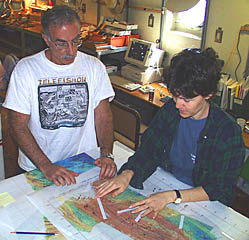
Mike Perfit and Maya Tolstoy plan the DSL-120 sonar survey for the 1°45’N study site. They are placing long white strips of paper that represent the 1000 meter width of each survey line on the multibeam bathymetry map. This helps them determine how much seafloor the DSL-120 sonar will “see” along each line.
|
© 2010 Dive and Discover™. Dive and Discover™ is a registered trademark of
Woods
Hole Oceanographic Institution
