|
|
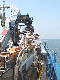
PJ Bernard (left) and Craig Elder prepare the DSL-120 sonar for its first deployment. The sonar “fish” is towed 100 meters above the seafloor. It produces sidescan sonar maps that give us very precise images of the seafloor’s structure and topography along swaths that are about 1,000 meters wide.
|
© 2010 Dive and Discover™. Dive and Discover™ is a registered trademark of
Woods
Hole Oceanographic Institution
