|
|
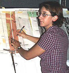
Clare Williams plots Argo II’s position on a seafloor map in the Control Van. She is using enlarged maps of the DSL-120 sonar imagery and bathymetry to make sure that we are going over the areas where we expect to find the recently erupted lava flow.
|
© 2010 Dive and Discover™. Dive and Discover™ is a registered trademark of
Woods
Hole Oceanographic Institution
