| Daily Updates: January |
| S |
M |
T |
W |
T |
F |
S |
| 23 |
24 |
25 |
26 |
27 |
28 |
29 |
| 30 |
31 |
|
|
|
|
|
| Daily Updates: February |
| S |
M |
T |
W |
T |
F |
S |
|
|
1 |
2 |
3 |
4 |
5 |
| 6 |
7 |
8 |
9 |
10 |
11 |
12 |

TODAY'S WEATHER
Broken
Clouds
80°F (26.7°C)
Latitude:
9 deg 36’N
Longitude: 104 deg 15’W
Wind Direction: NE
Wind Speed: 12 Knots
Sea
State: 3Swell(s)
Height: 9 Feet
Sea
Temperature: 83°F (28.3°C)
Barometric
Pressure: 1013.5 MB
Visibility: 15 Nautical Miles

Breakfast
Oatmeal
Potatoes
Quesadillas
Fresh fruit
Quiche
Pancake
Eggs of your choice
Lunch
Lentil and barley soup
Mozzarella sticks
Salad bar
Swedish meatballs
Club sandwiches
Dinner
Potatoes and carrots
Fresh Mahi mahi sashimi
Salad bar
Brussel sprouts
Cabbage
Corned beef
Daily Update: Dive 3539
February 5, 2000
By Dr. Dan Fornari and Sam Dean
Last night the Towed Camera Sled took 1,753 photos
of many different kinds of terrain on ocean floor. So far, the
tally is 11,484 digital pictures taken on this cruise! The images
taken last night included old, extinct hydrothermal sulfide deposits
and chimneys, crabs, starfish and many different lava flow types
and collapse structures. Some of the photos were a little too
close! The Sled “kissed” the seafloor three times!
The Night-Owl Camera Team may make it sound like it’s easy
to tow the Sled from behind RV Atlantis, but it’s
definitely harder than it looks. The Sled is attached to a 1/2” steel
wire that is spooled on an oceanographic traction winch mounted
under the fantail of the ship.
The seafloor here on the East Pacific
Rise crest is at about 2550 meters depth but because the ship
is moving at about 1/2 knot (or about 15 meters per minute) the
wire does not go straight to the bottom. If you have ever been
trolling for fish, the principle is the same; the wire ends up
being at an angle, so it takes a bit more wire for the Camera
Sled to reach the bottom . In general, when the Sled is at its
towing altitude, about 7 meters, above the seafloor, its position
is about 100-200 meters behind the ship. Hauling in the steel
wire or lowering it down is how they change the position of the
Sled above the seafloor.
The Sled has a 12 kHz (that’s the frequency
of the sound that it sends into the water) pinger mounted inside
the frame that sends out a sound signal that allows the scientists
onboard Atlantis to measure how close the Sled is to the
seafloor.
Unlike many of the camera tows done on this leg that traversed
relatively flat terrain, last night we were surveying down in the
Axial Summit Trough (AST) of the East Pacific Rise. The AST is
full of many interesting features, including tall lava pillars,
active and inactive hydrothermal sulfide chimneys, and walls that
can be 5-8 meters tall.
To visualize the technique that the Night-Owls are using to tow the Sled, and
the challenges they face, imagine a stage, like the auditorium in most schools,
with tall paper cups randomly distributed on the stage floor. Now, imagine that
you are up in the catwalks, where they have the lights, dangling a ball on the
end of a string just above the cups. Position the ball only an inch or two above
the cups-no higher and no lower. Now try to walk all of the way across the catwalk
keeping the ball at the same distance, 1-2 inches above the cups. Easy? Not really!
The “Night Owl” crew was faced with this type of scenario last night
as they used the traction winch to keep the Sled above most of the pillars using
the pinger trace to tell them how high they were off the bottom. They missed
nearly all of the pillars, but a few got “bumped”. The sturdy Towed
Camera Sled was built to last, however, and showed only a few minor scratches
when it came on deck! It went back into the water tonight at 1830 hours for the
last tow of this cruise.
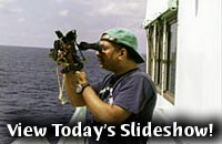
One popular past time amongst the Atlantis’ crew is fishing, but
the fish have been few and far between on this leg. After the bridge spotted
some birds feeding, the crew cast their fishing lines and - success - the fish
were biting! Check out today’s slide show and see what Ed Popowitz and
Bruce Strickrott were able to catch!
After lunch, the scientists and crew gathered in
the library to listen to Julie Barber speak about her experiences
as the “Our World Underwater Scholarship Society” (OW-USS)
Scholar. The OW-USS was established in 1974 to promote educational
activities associated with the underwater world. Each year a
Scholar is chosen who then participates in a variety of hands-on
activities and unique opportunities in underwater related fields.
Julie is on the last leg of her year-long journey, having traveled
across the US and to such amazing places as Egypt, Northern Ireland,
and her personal favorite-the Galapagos Islands!
While folks on board were enjoying the sunset, it suddenly got
very dark as a squall moved towards the ship. It was our first
rain of the cruise! The downpour sent many people on the fantail
scurrying for cover-but not quite all! A few of the scientists
and crew enjoyed the refreshing rainfall as they relaxed in the
pool after a hard (and hot) day’s work. After all, they were
already wet!
Dive Summary
On Bottom: 0929 hours
Off Bottom: 1506 hours
Maximum Depth: 2543 meters
Today's trip to the bottom in Alvin was the final geophysical dive of
this cruise. Dan Fornari, and graduate student Del Bohnensteihl of Lamont-Doherty
Earth Observatory went to the bottom with pilot BLee Williams. They ran a 1.5
kilometer-long line from South to North that crossed 10 of their previous East-West
lines, and then they continued to collect data on an additional 5 East-West traverses.
The North-South “tie-line” will give them important data to determine
the precision and repeatability of their continuous gravity measurements. Basically,
the concept of crossing lines when doing geophysical surveys is the same as any
experiment where you repeat it several times to be sure you get the same results.
Jim will analyze the data to check that he has calculated the same gravity value
at each crossing point.
The geophysical data recording in Alvin, which by now is routine thanks
to Dana’s logging programs and the reliability of the sensors and recording
system on Alvin, went very well and about 7.5 kilometers of track were run. At
the beginning and end of the dive, rock samples were taken of curtain-folded
sheet flows. The last sample was recovered from inside the east wall of the Axial
Summit Trough near 9° 38’N Latitude. We also collected a feather starfish
that was attached to one of the rocks.
Upon Alvin’s return to the deck of Atlantis, Margo, Greg, Julie,
and Paul gave Del, who had just had his first Alvin dive, a warm (or rather
chilly) reception! After being soaked with iced sea water, Del had to take a
quick swim in the pool in order to rescue his laundry. Congratulations on a successful
first dive, Del! And many thanks to the Alvin group and crew of RV Atlantis for
all of their help in making the collection of the geophysical data a great success.
|
