|
|
|
|
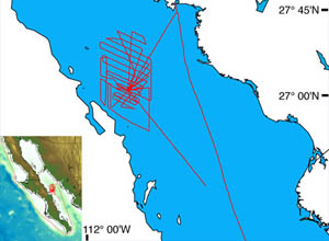
This detailed bathymetric map shows the multibeam sonar survey tracks conducted at night while Alvin’s batteries were charging. It is the first complete, detailed map of the Guaymas Basin.
|
|
© 2010 Dive and Discover™. Dive and Discover™ is a registered trademark of
Woods
Hole Oceanographic Institution
